Showing posts with label California. Show all posts

26 October 2005

San Diego

32'43.6"n 117'12.9"w
  • San Diego
Google Map
We left Avalon at 2:30am for our last California stop, San Diego. I was down for a nap at around 5am till 7am, then Tom went down for a few. We saw lots of dolphins today, at least 100. Totally cool because they would swim with the boat for awhile.

Tom rigged up his trolling line and mid afternoon we caught a fish! It turned out to be a 3ft long, 30lbs, shark! We would have taken photos except Tom broke the camera back in Marina Del Rey so you'll just have to believe all our stories.

We pulled into our last stop before Mexico at around 4pm. We're staying at the Fleet Anti-Submarine Warfare Training Center at the Point Loma Naval Base. I know what your thinking, but we get it for $10 a night. While coming down the cost I called every Yacht club and marina in San Diego and was quoted $100 a night for a slip. Forget about it! So, Tom played his retired military card and here we are. It's a small marina, 20 slips, but it's convientley located. It isn't costing us a fortune. And we aren't anchored out somewhere.

The next few days will be full of laundry, grocery shopping, fixing the camera, Mexico fishing license, visas and preparing for our Baja Ha Ha trip.

Love to all,
Amy
Photo Gallery
Photo Gallery

24 October 2005

Avalon

33'20.9"N 118'19.5"W
  • Avalon
Google Map
webcam
Well, left Two harbors Sunday afternoon in the cold, foggy and San Francisco like weather for Avalon. Avalon is 10 miles south, or a two hour sail.

Once there we checked for WiFi, met some other cruisers, and paddled to the dingy dock for a nice dinner on land. Last year Tom and our friend Chris and I went to Avalon and played this great fishing game. So Tom and I were really looking forward to playing. But someone broke it, so back to the boat for some local Telemundo.

Next stop, San Diego.

23 October 2005

Two Harbors, Catalina Island

33'26.5N-118'29.9W
  • Two Harbors
 Map webcam
Ahoy,
We left Long Beach on Thursday morning and motor sailed for 6 hours to Two Harbors on Catalina Island. The main reason for Amy and I to come here was that our favorite sailing magazine "Latitudes & Attitudes" was having a big party for all the boaters moored up here.

You cannot really anchor here and there are about 200 mooring buoys that fill most the bay here, once you get here the harbor patrol comes out in their small boat and shows you where to moor up at. All the boats here are moored really close together so we had a lot of new neighbors.

Our friends Ian & Heidi left Santa Barbara on Thurs night and sailed all night getting here on Friday morning. The boat right next to us had 2 guys on it that loved to fish, they caught 6 lobsters right under their boat and gave us their biggest which we boiled up and ate on Friday night!!

On Saturday the harbor filled up with boats from all over the place and we found that the dinghy dock was a little to crowded for us as all the boats here were trying to tie their dinghies up and you had to walk over 4 or 5 other boats just to reach the dock, so we just paddled ashore and carried ours up the beach. There were boater lectures during the day, then at sunset the bar opened with free rum & Beer(this is really why we came).

There was a giant grill that everyone cooked out on and there was food that Latts & Atts provided as well, and a band that played on the beach. Amy made a giant pot of pasta salad that lasted less than 10 minutes and I don't think she ever had time to get any on her plate before it was all devoured. I even won a beach umbrella, beer holders that fit on the winch's, a hat, and a fishing lure!!
Tom

Photo Gallery

19 October 2005

Long Beach

33'58.9N-118'26.8W
Google Maps
Greetings,

I hope this finds everyone happy and healthy. Tom and I are at the "Fluff and Fold" in Long Beach. One thing about the boat is that everything smells. Mildew is gross! I can't believe we walk around smelling like that. Things have been extremely wet here!

Pulled in Sunday night during a storm. After calling every yacht club and marina twice we finally found a place to stay. It's a fine place to stay except the harbor master wouldn't wait an extra 10 minutes for us to pull in, so we don't have a key for showers. If it wasn't for Jesus, the maintenance man, we wouldn't even be able to leave.

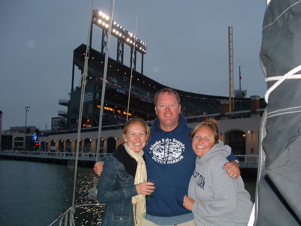
Met our friend Katie and her second mom Cindy for dinner Sunday night. We are hoping to see Katie a few more times before taking off.

Sunday night I didn't sleep at all. Lighting, thunder, water spouts = scary time on the boat. First times it's rained in SoCal since last year. In the past 3 days they've had more rain than all last year.

We spent yesterday at "The Happiest Place on Earth". That's right... Disneyland. What a blast! You're never to old to enjoy a day with the big mouse, even if it downpours throughout the day. The Jarmen clan met us at the park, as they had to leave their boat in Santa Barbara to get the work done. I think they had a good time even though everyone was soaked to the bone. Disney is celebrating it's 50th anniversary and reopened Space Mountain with way cool special effects. It totally kicked ass! We stayed until the end of the night for the spectacular fireworks show. Disney has spared no expense for the big celebration. My cousin Bob was able to join us for the day too. So that made it even that more special.

Hopefully the rain stops and we can walk the beach tomorrow and dry out the boat. We leave for Catalina on Thursday, with the big party Saturday.

Keep in touch
Amy


Ahoy,
Katie totally hooked us up last night and let us spend the night at her and Ben's condo. We got to crash there, eat pizza, and hot tub!! Katie was also able to get our mail that my sister Janice has been holding in Salem, Oregon since we left Oakland, Which was nice since some of the mail was boat parts.

Amy and I spent the day doing laundry, went shopping, and explored.

Our next stop is Two Harbors at Catalina Island on Thursday afternoon for a big boaters party held by Lats & Att's Magazine. There is supposed to be lots of crazy sail-boaters there and we plan to be right in the middle of the party!!

Today we returned the rental car, then walked through Long Beach?(10 miles), having a few pitchers of Margaritas along the way. There was a filming of the TV show "Cold Case" right in front of our yacht club. So we took a few beers out and watched all the made up people walk around.
Tom

Photo Gallery

16 October 2005

Marina Del Rey

33'58.9N-118'26.8W
Google Maps
Greetings from Marina Del Rey,

We got an early start today at 7am from Oxnard and left before we even had breakfast! As usual there was low winds and we motor sailed to Marina del Rey. I think that when we have a time line its better to run the engine and have the sails up making sure that we make it in to port at a good time! Did get to see lots of porpoises today and they were all jumping out of the water around Sandpiper.

Tom went to pump out the holding tank when we were off shore and ended up closing the wrong valve making the hose come off and emptying the tank inside the head, nice mess!!

We came in the harbor and called all the yacht clubs here, and the California YC said that they would give us a slip. We pulled into the slip which oh by the way was for an 85ft mega yacht. The slip is so big we had to have extra lines hold us in as the cleats to tie the boat off were too far apart and our regular power cord doesn't even fit because we are not big enough. We could almost get stuck sideways in here. This is by far the nicest yacht club we have been to and we are tied up between 2 huge mega yachts that are at least 85ft long. Sandpiper looks a little funny here, especially with all the junk all over the boat and towels hanging out to dry. They also have a pool that we are planning to crash later!

My dad use to live here back in 92 and so did Shannon and I for the summer. So when we pulled in I knew where to take Tom "Killer Shrimp". It's one of Bob's favorite and mine too. After dinner we headed toward Venice Beach, walked the boardwalk all the way to Santa Monica. I was extremely hesitant to ride the ferris wheel but Tom talked me down from that ledge and I rode. I hate heights. Rode the roller coaster and the bumper cars, kicked Tom's ass at air hockey in a cab and back to the yacht club for some cocktails, then to the boat.

Tomorrow our plan is pool, brunch and then off the see friends and family in Long Beach. Wish I could stay here in LaLa land forever.

Amy

Photo Gallery
Photo Gallery

15 October 2005

Oxnard

34'09.8N-119'13.5W
Google Maps
Greetings from Oxnard,

We left Santa Barbara at 10am saying good bye to our friends Heidi & Ian who are staying there for a few more days to have their boat repaired from a boat that hit them when they were anchored in San Simeon. Got to put up all the sails when we left the harbor and got to put up the new spinnaker, I think Amy had tears in her eyes as it was so beautiful. As soon as we were going a good 7 knots all the wind stopped and we had to motor the rest of the way to Oxnard where we arrived at 5pm.

We are moored up at the Channel Islands Yacht Club where they gave us a free slip for the night and let us use their showers. Amy and I had dinner at the "Whales Tale", its a really cheesy seafood restaurant that looks like it was happening back in the 70's, they even had a salad bar that was a boat! Then to the yacht club for some cocktails, and back to the boat for the night.

We are leaving early in the morning to get to Marina del Rey which is a 10 hour run.

If you have been checking this BLOG site and are wondering how this is getting posted, here's how it works. I am able to email from the boat using my laptop that is connected to a modem that is connected to an ICOM HF radio. The email is sent to my brother in Australia and he posts them on the BLOG. The "photo album" link on the lower right side of the BLOG page we are able to maintain whenever we are able to get internet access which has been a little more difficult to get. We got lucky in Monterey as there was WiFi in the marina that we were able to connect to.

Tom

14 October 2005

Santa Barbara

34'24".3N 119'41".4W
Google Maps
Oh snap! Southern California is so nice and warm, actually hot, 93 degrees.

Arrival was uneventful, no sailing, sometimes we think we should just own a power boat. Arrived in Santa Barbara checked in with Habor Master, moved boat to slip and finally showered. Man was that nice. We sure did need them. Check in at the yacht club, fancy. Walked up State Street with the kids to a Taqueria and then crashed out.

Thursday Tom and I walked the rest of State street, saw a movie, "Two for the Money", it was OK. A little long. Tom's brother Ron use to live here so we checked in with a few of his friends too.

His friend Captain Paul lives on a 54ft Grand Banks, only 4 ever made, WOW! Also, had dinner with his friends John and Robin. It's nice getting in a car and going out. Checked in with our Canadian friends who had a rough time coming down the cost. They hit big winds and even bigger waves. They said at one point they were so high on a wave they didn't know which way they would come down, when they finally came crashing down they were going 12 knots, that's crazy talk in a sailboat. They said after that they were ready to pack it all in and head back home but a fellow boater talked them down.

Next stop, Oxnard.

11 October 2005

Cojo Anchorage

34' 26".96N 120' 26". 45W
Google Maps
We made it!

It's Wednesday morning and we are doing some serious rockin' and rollin' in the Cojo Anchorage. Cojo is the spot right around the corner from Point Conception. So much talk about how scary this part of the trip can be but we lucked out, watched the weather real close and had no problems. We had our own convoy of boats everyone making it safe and sound.

After some breakfast we will pick up the anchor and head for Santa Barbara about an 8 hour sail. We are officially in southern California so we are hoping to get to some warmer weather soon. I'll write more when we get to Santa Barbara and aren't rockin' so much. Love to all.

Amy

Photo Gallery

10 October 2005

Port San Luis

35' 21".76N 120' 51".16W
Google Maps
Ahoy,

We left Morro Bay this morning after topping off the fuel tanks and followed our friends Ian & Heidi on their boat to Port San Luis, which is 20 miles south of Morro Bay. We got to see some whales at a distance on our way out and lots of sea lions all over jumping out of the water to check us out. No sailing today as no wind, so 4 hours of motoring and now anchored right off the beach and wharf till tomorrow morning.

This is the last stop before Point Conception which is about 60 miles from here and is known for is strong wind and seas, we have been watching the weather very closely and this is the best day for us to go. Point Conception is known as the "horn" of California and all the boats we are with are transiting on the same day.

There is not much here at Port San Luis, they have a hot springs here, but trying to get ashore and back is time consuming so we will be staying aboard tonight and leaving early in the morning.

Tom

Photo Gallery

09 October 2005

Morro Bay

35' 21".76N 120' 51".16W
Google Maps
Greetings All,

Hope this finds everyone well. Tom and I are at the Morro Bay Yacht Club and have been here since Friday morning.

While in San Simeon we went out for what was suppose to be an uneventful kayak ride and turned into a big challenge. Things were going just fine, Tom and I both made it to and from the beach without rolling our boats but on the paddle back to the boat the wind picked up and caused a small swell and a big challenge getting back on the s/v Sandpiper.

Early the next morning we picked up anchor and headed out for Morro Bay. It was an uneventful motor sail until pulling into Morro Bay. The fog started to get real thick and it's a pretty tricky harbor to pull into. We made it to the Yacht club and were greeted by our friends Ian and Heidi and their two little ones.

My friend Johanna came and picked us up friday afternoon and took us to the famous Taco Temple, oh man was that good food, warm chocolate bread pudding made from a crossant! Friday night was happy hour at the club, met lots of great folks, these Yacht clubs are really working out great for us.

Tomorrow were casting off for the next port, Port San Louis, a four hour sail from Morro bay. After that is the big jump around Point Conception or "The Horn",apparently, quite the tricky sail.

The weather looks like Tuesday is going to be a good day for us to take on this challenge so look for a posting after that.

Love to all,

Amy

Photo Gallery

06 October 2005

San Simeon

35' 38.3"N - 121' 11.4"W
Google Maps
Ahoy,

The Sandpiper is safely anchored in San Simeon after a 90 mile sail down the coast. We left Monterey at 3am Wed morning after waiting for a good weather window for getting around Big Sur. This stretch of coast can be really nasty and is known for its high winds, if you get into trouble here there is nowhere to pull into. We motored in some wide swells and was able to motor under a reefed main as the wind was from dead astern all day and we were surfing down 15ft swells. All in all it was a good trip and only had to adjust the sails once, and the auto pilot was able to do all the work for us. The trip was about 16 hours and we anchored in San Simeon just as the sun was setting, perfect timing as pulling into an unknown anchorage at night is not allot of fun. Another great piece of equipment that we get tons of use out of our SIRIUS satellite radio, if you don't have one get one!!

San Simeon is really just a small anchorage as there really is not a town here. Hearst Castle is just up the hill from here and there is a small camp ground, but that is about it. We are going to stay anchored here today as it is nice and sunny today and will head South to Morro Bay tomorrow morning to meet up with friends on another boat that are sailing to Mexico as well.

Tom

Photo Gallery

02 October 2005

Monterey

37' 30".1N 122' 29".0W
Google Maps
Greeting All, It's First Mate Amy.
Well, we have arrived in Monterey today sailing from Moss Landing. Our sail from Half Moon Bay to Santa Cruz was uneventful which is always good. Once in Santa Cruz we anchored out by the pier and all of the loud sea lions. We got a gold star that day because we didn't spend any money.

Early the next morning we pulled into the Santa Cruz Harbor, showered, walked the boardwalk and then checked out the Yacht Club. The club was great, everyone was supper friendly. We ate dinner there and got lots of sailing advice from some salty dogs. I didn't want to leave Santa Cruz without riding the famous Giant Dipper roller coaster so we did that sat. afternoon and then had a perfect sail to Moss Landing. The weather was great and we had the boat cruzing at about 7knots which is really good for the sandpiper.

Once in Moss Landing we tied up at the Elkhorn Yacht Club again meeting lots of friendly folks. That night we gorged ourselves at one of my favorite seafood shacks, Phil's. Years ago Tom and his dad use to have their fishing boat in Moss Landing and would sell their fish to Phil. This morning we went to visit Tom's dad at the Fisherman's Cemetary, had breakfast and then had a nice sail to Monterey.

We plan on being here until Wed. Hoping to wait out a storm and leave for our big 17 hour sail to San Simeon. Hope all is well with eveyone. Tom and I are always available by cell if you like to give us a call. 510-637-8130

Photo Gallery
Photo Gallery

01 October 2005

Santa Cruz

36'57.5N-122'00.9W
Google Maps

Hi Everyone,

We are anchored by the fishing pier in Santa Cruz and got here at 4pm yesterday. We are here with a few other boats and are right off the beach where the boardwalk is. Don't think that we would want to stay here another night as there are hundreds of sea-lions under the pier all barking at once.

We left Half Moon Bay at 7am and motored most of the morning about 3 miles off the coast. We had a really good trip on this stretch as once we turned left out of the harbor we had the seas off the Stbd quarter making the the trip fairly smooth, we even we able to try out the new main sail while we motor sailed giving us about 7 knots. So far the most used equipment is the auto-pilot as all we have to do is lay back and read. 2nd is the new handheld GPS plotter that we have in the cockpit and can hold in our hands as we are pulling into port.

Its 9:30am and Amy and I having coffee & tea, we are about to pull up anchor and head into the marina in Santa Cruz harbor and spend the night here, the yacht club here gives discounts for mooring up and has internet access, we will try to update our "photo album" pictures tonight.

Tom

Photo Gallery

29 September 2005

First day at sea

37' 30".1N 122' 29".0W
Google Maps

First Mates Log, first email written from our new sailmail account.

Left the Presidio at 5:30am, was really dark and cold but no fog. Once we headed out around the corner for Ocean beach I started not to feel so well, vomit episode number one. We had no wind so motored the entire route. Got real cold off shore, stuck in a trough, vomit episode number two. With all the rocking of the boat it put me right to sleep, woke to vomit episode number three, then some more nap time. Tom's a great Captain and enjoying all his gadgets.

The new handheld chart system is really cool, even I think so.

We arrived in Half Moon Bay this morning around 10:00am. Went to get something in our stomachs, took a nap, and then I washed the port side of the boat. This evening went and bought dramamine, checked out the yacht club and then the Half Moon Bay Brewing Company.

Tomorrow we should arrive in Santa Cruz around 4:00pm, where we can add some new photos to the blog. Hope to hear from you all soon, remember text only please.

First Mate Amy

Photo Gallery

14 August 2005

Dave Matthews concert at Pac Bell Stadium


We just spent the weekend anchored at Pac Bell stadium for the Dave Matthews concert. Our friends Jen and George came along as well, the sound is pretty good here as you can get in really close to the stadium.

03 March 2005