Showing posts with label Mediterranean. Show all posts

05 November 2008

Tangier, Morocco

Med Moored in Tangier Harbor
Tangier
Morocco
Gateway to the Atlantic, North African Coast
Mediterranean Sea
35'47.2N/5'48'3W

Sandpiper is currently Med Moored in Tangier Harbor with three other boats side tied to us. We checked the weather and its looking like we might make it all the way to the Canaries with the weather that is being forecasted. So we will be heading out tomorrow morning after checking out with customs and police.

Amy has written the update for this stop. But due to the sketchy circumstances here in the harbor we will be posting this entry one month from now when we are far from this port. So stay tuned...

Hopefully the next entry has us in the Atlantic!!
Tom and Amy

03 November 2008

Tangier, Morocco

Anchored in Tangier
Morocco
North African Coast
Mediterranean Sea
35'47.0N/5'47.7W

Sandpiper is currently anchored off a long row of hotels at the city of Tangier on the north coast or Morocco, Africa. We had spent the last several days hiding from the weather at Hercules Marina in Cueta, Spain, waiting for the westerly winds to die down so we can get out of the Med.


Spain drives me a bit crazy as it seems like every time we go ashore all the businesses are closed all afternoon. If we are lucky, they might open up at some random time for a few minutes, then remain closed for the remainder of the afternoon. About 9pm all the businesses open back up, and by midnight everyone is out shopping or having dinner. If you show up at a restaurant at 9pm, it is too early to have dinner. So you have to wait till later.

People seem to go out for dinner and shopping at 11pm and then stay out all night. I have no idea how Spain's economy functions. Saturday was 'All Saints Day'. So once again everything was closed, Then Sunday everything is closed again.

Anyhow, being in a marina in Spain when it is pouring rain and everything is closed all the time, we had to spend our time down below just trying to stay warm and dry. We have spent the last couple years living on the equator in shorts, and when we go ashore, maybe a shirt to look dressed up. Winter has been showing up with a vengeance and now when we leave the cabin we are wearing shoes, socks, sweatshirts, pants, and jackets. Our nice golden brown tans have faded away to a pasty white. All the Europeans here are walking around in full jackets with fur lining and boots. They stay warm by hiding in heated coffee shops.

We dug through Sandpiper and found the electric heater that we have not used since being tied up under the Golden Gate Bridge. And being in a marina, we were able to plug it in to keep the cabin warm.

This morning Amy went to the grocery store for some last minute supplies (it was closed when she arrived). We topped off Sandpiper's water tanks, then went to McDonalds to get lunch to go. We found that they too were closed. We tried to pay our bill at the marina office. That was closed. We pulled up to the fuel dock. That was closed.

By 1130 am the fuel dock opened up and we took on 100 liters of diesel, the headed west down the Straits of Gibraltar, skirting the shipping lanes and dodging fishing boats. We were hoping to be able to enter the Atlantic. As we approached Tangier the winds died down. We talked to the U.S catamaran 'Following Tides' who had just turned left outside of the Straits. They told us that winds were calming down. So we decided to drop the hook here in Tangier to see what the weather is doing tomorrow morning.

From here it is only 6 miles to the Atlantic Ocean. Once there we head south for 600 miles to the Canary Islands. We might wait here for a few days till we can be sure we are going to have good winds. If we do stay we will pull into a marina tomorrow morning. If not, then we will head out to hopefully sail.

More later, once we make a decision.
Tom and Amy

02 November 2008

Is it Cash? Or is it Hash?

Team Sandpiper Update 2 Nov 2008
Side tied at Tangier Municipal Marina
Tangier
Morocco
North Africa, Gateway to the Atlantic
35'47.1N/5'48.3W

Is it Cash? Or is it Hash???????


Let me set the scene for the evening: It is 9pm in cold, dark, wet sketchy Tangier, Morocco. We are side tied to a derelict boat. In fact, all of the boats in the harbor are derelict, except for the Sandpiper. We had a great day zig-zagging through the alleyways of the Casbah, poking our heads into shops along the way. We are now back on the boat, trying to keep warm and dry, enjoying dinner and a movie.

We have taken a few breaks throughout the evening to poke our heads up top and have a look around at what is going on in the harbor. Tangier is a dirty and busy harbor with thousands of stinky fishing vessels of all sizes moving in and out of the harbor at all times of the day and night. This last time we went topside we noticed the Harbor Police towing a large sport fishing vessel, and they appeared to be headed straight for Sandpiper.

Sure enough, moments later we have a 40-foot sport fishing boat tied off our starboard side. It is never good to have to be towed in. And to do so at night just adds to the drama of it all. So we stuck around outside asking our new neighbors "What went wrong? Why are you being towed in? Where have you arrived from?"

Soon after meeting the sweaty, nervous looking, talk a mile-a-minute, neck tattoo covered Captain we were privy to their story. It seems that this "gentlemen" and his crew, whom he had never met before this morning, have been hired to deliver this boat somewhere across the Straits. After they arrived on the boat, which by the way has no name or numbers on it, they got just a few miles out of the harbor when the engine died. The Captain also reports that his cell phone wouldn't work, claiming that it had no signal, this being only 2 miles from port. He thinks the police are following him and are intercepting his cell phone. This prevents him from being able to call his local 'boss' and he is now forced to deal with local authorities.

It is not until hours later that they give up on the engine and are in fact towed in by the local authorities and his cell phone magically starts working again. I should also mention that while he is sharing this info with us, he is downing shots of vodka like a loyal comrade. Their boat is currently secured next to us, and streams of officials are coming off and on it, which means they are stomping over Sandpiper too (here, everyone side ties to the last boat in).

This, of course, is all so fantastic to us and is the most excitement we have ever seen in such an exotic harbor. The movie will have to wait. While one official goes onboard, another arrives. Our new neighbor is getting antsy and sweatier, but he still managing to chain smoke, occasionally hack up a lung on us, and do more shots of Vodka. Baksheesh, a form of payment/bribe, is part of the culture here and a pack of cigarettes is the norm. He told us that one of the officials asked for cocaine as his payment. Interesting…

After the last official leaves the Captain says "I want you to know that people have been shot here in Tangier because of what you saw here tonight". This of course didn't stiffen my curiosity of what was going on over at his boat. So I started asking "What is the name of your boat? What kind of boat is it? Where are you going? Where's all your fishing gear if you're a fishing boat?" To which he looked at Tom and said "Your wife asks a lot of questions" as Tom is giving me the hand across the neck motion. Tom had figured out what was going on as soon as the boat tied up next to us. It had no name or numbers, and the captain not knowing where any of his boat's mooring lines were stored.

From the bits and pieces of what we could gather from the captain,  it seems that he had just arrived this morning. He was hired to take this recently hauled out boat out of the country and deposit it somewhere else. With our minds racing, and few details given to us thanks to shots of vodka in the skipper, we gathered this vessel's recent yard work included hollowing out the insides of the boat, adding false compartments, and filling them with cash, hash, or who knows what? 

Needless to say, it has been an exciting fews days here in Tangier. As we spent hours the next morning trying to clear customs we asked our new friend how he cleared out. He stated "It was taken care of..."

Cheers,
Amy and Tom

30 October 2008

Ceuta, Africa

Med Moored at Hercules Marina

Ceuta (aka Sebta)
Spain
North African Coast
Mediterranean Sea
35'53.3N/5'18.7W

The weather has been constantly getting worse day by day. After 24 hours of 30 knot winds at anchor, with boats around us dragging anchor, and not being able to leave the boat, we decided to move somewhere safer. Another low pressure system is supposed to blow through tomorrow and we do not want to be at anchor for this one.

When we woke up yesterday the winds had dropped down to 15 knots. So we quickly got Sandpiper secured for sea and picked up the hook. As we left the anchorage we kept getting calls on the VHF from the other boats we had been anchored next to asking where we were going. They did not want to be stuck in Gibraltar any longer either. We headed south, across the Straits of Gibraltar, 15 miles of dodging all the East/West shipping traffic to where we are currently secured in Hercules Marina in Cueta, Spain, in Africa.

One thing about 'cruising' is that we get an 'in depth' education about countries along the way. I had no idea that Spain had territory in Africa. But it does! Cueta is on the North African coast. It is a small Spanish territory along the Moroccan Coast just south of Gibraltar. It has been here since 1640. It is only 20 miles square, surrounded by Morocco. Cueta is a bustling town, right on the water with its preserved old city walls and navigable walled moat. Hercules Marina is a very convenient marina with everything we could need right across the street... grocery stores, a public market, Internet. There is even a McDonald's just a feet away.

We had hoped to be here just for a few days till this next low pressure system blows through tomorrow. But the weather forecast is not looking to good for us. The next 5 days predict winds coming out of the SW,  the direction we need to go. There is a group of about 10 other boats between here and Gibraltar that we have gotten to know during the last several weeks. They are all more then ready to get moving to the Canary Islands.

If it looks like we are going to be here more then 2 days due to weather, then we are going to plan some inland travels to Morocco while the Piper stays safe and sound in Hercules Marina. 

More later!!
Tom and Amy

Notes From Ron:
  • Ceuta is believed to be the location of of the African Pillars of Hercules. Hence the name of the marina.
  • Morocco has wanted Ceuta, Millina, and the uninhabited islands of Perejil transferred to them from Spanish control. In fact, Spain and Morocco got into a shooting war over the Perejil Islands back in 2002 when some Moroccan soldiers set up a camp there.

27 October 2008

Still in Gibraltar

Gibraltar

Gateway to the Atlantic
Mediterranean Sea
36'09.7N/5'21.8W

A week has gone by since our last update and I am sad to report we are still at anchor at The Rock. This past week has been a constant back and forth to land where we are able to check Internet and the weather. We have been receiving weather gribs on the boat as well. But with the strong winds predicted, it is better to use more than one resource.

In the midst of all the land trips we were able to get propane with the help of Don from S/V Redwood Coast and Tom from S/V Two Extreme. Once Tom and Don signed their lives away for two propane tanks, purchased an EU valve, and borrowed Tom's fitting things, things were looking up. The rig was hooked up with the full bottle a bit higher for the liquid propane to drain into our empty tank and so we waited. We weighed the tank every 30 minutes and... nothing.

A few hours have now passed. As our last resort, we look to see if Mr. Nigel Calder has written anything about this process. For those of you who don't know who Mr. Calder is. He is a boat electrician guru. And you can guarantee that every cruising boat has his books on board. We were in luck and found a mention in his book. Mr. Calder suggests pouring hot water over the full tank to heat up the liquid so it passes faster. [From Ron: Here is a way to transfer propane without hot water]

After moving the tanks up forward, securing the full tank, upside down, to the boom for more leverage, we then poured hot water on the tank. And just like Mr. Calder promised, we could see it flow. And with one tank full, and another half full, we are happy campers. It is by far the most expensive propane we have purchased because the store decided not to return our deposit. But, we are full.

Also this week our outboard motor has been acting up again causing us to have to break out the oars and row a few times. And with the heavy rain and winds here, rowing is no cup of tea. Last night was the straw that broke the camel's back because once back in the dingy we noticed we lost a oar, and the outboard decided not to run. With only one oar, and a flip-flop for the other paddle, it was a long trip home. We decided to take her apart one last time today, Tom spliced the wire to the spark plug and first pull, she started up. She's been doing good all day. So fingers crossed we don't get stranded again because we only have one paddle and the flip-flop didn't work so well.

Our trip into town yesterday consisted of us at the Internet checking weather once again. Last we saw it wasn't looking good for us to make the Canary Islands. There is talk of a nice marina in Rabat, Morocco (Africa) just 230 nautical miles from here. So if we could make that we would try. However, what we saw yesterday was predictions for the wind picking up today and tomorrow. Maybe a break on Wednesday for us to make the trip to Africa. But if not a nasty looking front is coming in over the weekend. So we may be here for another week. Of course we will keep you posted after our weather check tomorrow.

Cheers,
Amy and Tom

21 October 2008

Gibraltar

Gibraltar , Gateway to the Atlantic

Mediterranean Sea
36'09.7N/5'21.8W

Happy Trafalgar Day! Sandpiper is still anchored just under 'The Rock' waiting for favorable winds to blow us to the Canary Islands 700 miles south of here.

Since arriving we have been busy exploring the surrounding area and getting the 'Piper ready to leave. The only safe anchorage in Gibraltar is north of the runway that separates Spain from Gibraltar. Being on this side of the border (Spain), then crossing over to Gibraltar is a bit like crossing over to Tijuana. We go from one country where no one knows what we are saying to a country where everyone speaks English, our first English speaking country since leaving Australia.

Gibraltar is rich in maritime history. It is only two and a half miles long and barely a mile wide. Most of the country is an enormous rock that forms a peninsula. The rock drops from a hight of 1400 feet to sea level.

Gibraltar has been a part of all major wars for the last two centuries. For a little history... Gibraltar was used as a base during the battle of Trafalgar. And it is where the body of Admiral Nelson was brought ashore by HMS victory. Gibraltar was also a major base in WWII, used to block German shipping from entering or leaving the Med. And to try to trap German U-boats. You can see this in one of the greatest movies ever made about WWII called 'Das Boot'. Towards the end of the movie, after their brutal Atlantic patrol, they have to skip pass the Royal Navy at Gibraltar to try to get back to their base in France.

Since our arrival to Spain at our last stop in Almeria it was never clear where we were supposed to check in. So we never did, figuring we would do it once we got here. Now that we are here, once again no one can tell us where to go to check in. And it seems that no one really cares. When we walk across the border from Gibraltar the Spanish customs officers ask us where the stamps are in our passports.  We explain that we can't figure out where to check in. So they say "That's OK. Don't worry about it." I believe that none of the other boats here are clearing in or out either since its to confusing on the Spanish side. And it is so busy here that they are not too concerned with the visiting yachts.

Storm Update: That storm that blew through here 2 weeks ago, the one we hid from in a marina in Almeria, Spain. That storm was only forecasted to blow 30 knots. Turns out that same storm was the worst storm Gibraltar has experienced in 40 years. Most people we talked to say they have never seen anything like it. Along with the broken ship on its coast, the storm caused much damage to the harbor, with both marinas being closed due to storm damage. [Video of damage]

One of the things we have been trying to accomplish these last 4 days is trying to get Sandpiper's propane tanks refilled. While this is always an adventure in every county we have visited, we have always found someone that had the right fittings to top our tanks. Here in Europe, everyone swaps their empty bottles for full ones. And it is illegal to refill tanks in Europe. We have only recently been educated on this after the last 4 days, one of the days walking around town with our propane tank behind us on a small cart only to find out that no one could help us. Sandpiper has to large propane tanks that have lasted us since stopping in Egypt.  But are now they are almost empty. We are not sure that we want to leave on this next 700 mile passage with a chance of running out of propane en route. So we might be staying here for a few days until we can get this worked out.

We are working with another California boat to get the right propane fittings to fit the EU bottles. If  that works, then we will just connect the European bottles to ours and fill them that way. Hopefully the next entry we will be at sea cooking something.

More soon,
Tom and Amy

17 October 2008

Gibraltar

Gibraltar, Gateway to the Atlantic

Mediterranean Sea
36'09.7N/5'21.8W

Sandpiper is securely anchored in Gibraltar, right under 'The Rock'. From where we are anchored, we are just under 'The Rock' and it looks just like in the Prudential logo "Get a piece of the rock". We made much better time from Almeria than anticipated and was able to set the hook before the sunset among about 20 other boats from all over the world.

I had said in my last update that we were not worried about a night approach to the anchorage here. But now that we are here, I take that back. I had not anticipated the amount of shipping underway and at anchor and at anchor. Gibraltar is a crossroads for mariners traveling to the Med or to the Atlantic, and most yachts stop here, along with a lot of ships.

As we have stated previously, the weather in the Med can turn bad in a very short amount of time. This is why we were quite happy to motor in windless seas. As we approached Gibraltar, right under the lighthouse were the remains of a ship that was pushed up on the rocks just last Friday in a major storm that blew through thru. The ship was at anchor and when the storm hit. They drug anchor right onto the rocks. Some of the crew was taken off by helicopter until the helicopter had to make an emergency landing due to mechanical failures. The rest of the crew was taken off by a crane that lowered a basket down to them from the cliff above. While this was going on, the ship cracked in half. When we passed yesterday there were salvors all around the remains mostly trying to pump the ship's fuel out. We passed thru some of the fuel in the water, and the main port was closed off with oil booms to protect the boats in the harbor.

When we approached the anchorage we stopped and talked to a small Canadian boat that had been here for the last week, after a transit from New York. They told us that they had been anchored there when the storm blew through, and they showed us where a section of the break wall used to be. The waves were so large that inside the bay that the waves tossed all the rocks off the middle of the break wall. This was the same storm that passed over us last Friday after our arrival to Almeria. Lucky for us we were no longer in transit from Malta when this passed over.

One note to add about this area. The border between Spain and Africa is wide open for smuggling, mostly people and cigarettes. We had one small inflatable boat with 3 persons onboard pass us, headed from Spain to Africa, when we were 20 miles offshore. These guys looked pretty suspect being so far offshore in a small inflatable.

Gibraltar is just a small piece of land that is self governed and is a territory of England. But the land just off our stern is Spain. After we got the hook dropped last night and had gone to bed we heard a small outboard and Spanish voices. I popped my head out and saw 2 young guys in a dinghy holding on to our starboard side talking into a hand held radio. I said "Hola", and they started pointing outside the anchorage and then at us saying "police". I was a bit confused. At first as I thought they were saying that THEY were the police and that we had anchored to close to the Spanish side of the border between Gibraltar and Spain, and were asking us to move.

They kept chatting into their radio. With my very broken Spanish, and a lot of pointing, they told me that they were smuggling cigarettes with their dingy between the Spanish shoreline and Gibraltar. I am not sure which way they smuggle the smokes. They told me they were hiding from the police who were out in boat looking for them, and a friend of theirs was on a radio telling them where the police were. Once the coast was clear they took off, saying 'Adios'. At least they were honest smugglers and told me everything they were doing.

Our current plans are to stay here till we get a good enough weather window to head south to the Canary Islands 700 miles from here.

More once we step ashore.
Tom and Amy


Notes From Ron:
  • The cigarette smugglers are bringing cigarettes in to Spain, via Gibraltar. Here is an article.
  • Technically, Tom and Amy are in Spain. They are anchored just a few yards north of the border.
  • Gibraltar is so small that the only road in and out of the country has to cross the middle of the county's only airport runway. Take a look.

16 October 2008

2008-Oct-16 Update

5:30am Position

36'21.3N/4'09.3W
Spanish Coast
Mediterranean Sea
  • 90 nm from Almeria, Spain
  • 60 nm to Gibraltar
  • Winds W 5 knots
  • Seas F.A.C. (calm)
After getting last minute hot showers, one last grocery run, and securing Sandpiper for sea we left Almeria, Spain at 10am for Gibraltar. The weather the next 48hrs is forecasted to be less then 10 knots from the west. So most likely we will motor the whole way to Gibraltar. For Friday the winds are forecast to go back up to 30 knots.

It is 5:30am and the sun is just about to lighten up the horizon. Since leaving Almeria we have been motoring along the coast up Spain averaging 5 knots. This is better then expected as we are supposed to have a current against us and so far we have not seen it. The seas have been flat calm with a light breeze off the bow, Right after sunset a full moon rose up right off Sandpiper's stern. It has been a perfect evening for motoring on a glassy sea with porpoises jumping around Sandpiper's sides all night long.

We are near the Spanish coast and clear of most shipping traffic with just a few ships passing us during the night. Right at sunset the Spanish Maritime Police ran down our port side at high speed out on patrol.

With only 60 miles left to go we are hoping to have the hook set before sunset tonight at Gibraltar. But if not, we are not to worried about a night arrival as there are no shoals in Gibraltar's harbor. And it is very well marked.

Hope next entry finds us with our hook set under 'The Rock'.
Tom and Amy

14 October 2008

Almeria, Spain

Med Moored at Club de Mar Almeria
Almeria
Spain
Mediterranean Sea
36'49.8N/2'27.6W
(click on photo to enlarge)

Since our arrival we have been enjoying marina living with all we can use power, high speed WiFi Internet, and hot showers. We now have a new U.S. phone number. So if you would like, give us a call at 317-608-2844.


Almeria is a city and is quite busy during the day, and at night there are restaurants and bars full of people everywhere. Several nights ago ‘Team Sandpiper’ decided to hit the town and see what happens during the evening hours. One great thing we discovered about ordering beers in Spain is ‘tapas’. Every time we ordered a beer we got a small plate of food from the bar. We were going to go out for dinner, but figured that we would just keep going to different bars, ordering beer, and by the time we were full of beer we would be full of dinner. There are many small bars all over this city all down different small alleys.

By midnight we were full of ‘dinner’ and decided to see what else was around. One thing about being in Europe is that people do not come out till late in the evening for dinner. If one walks around at 9pm there are no people anywhere. But at midnight, every business is packed. We stopped in one bar that had a very good price for ½ liter of beer in a plastic cup. Everyone was in black Metallica t-shirts and very young. I fit right in as everyone was in his or her early 20’s and  smoking cigarettes and I am in my 40’s wearing my best white Mexican shirt. It was like drinking at somebody’s keg party back home in a dark basement.

After that, there were more stops at some very crowded bars, and one last stop at a bar that was full of hundreds of people all dancing to some very loud music. By the time we decided that is was time to head back to the boat it was 5 am and the skies were starting to lighten up. Once we stepped outside we saw a huge line of people waiting to get in... AT 5 AM!!

One reason we stayed here for the weekend was that we dropped off laundry to be washed on Friday and they were closed on Monday for a holiday. So we could not leave without our clothes. Also, we have had a few boat projects to complete before leaving.

We had a refrigeration technician visit and look at our system that has been giving us much drama. He figured the control unit was bad and that the unit needed more coolant added. Just like when we were in Turkey, this tech added too much coolant, and once he left after two hundred dollars out of our pockets the refer completely freaked out. Anyway, since I have been staring at this system for hours every day I figured out what was wrong as soon as he left. Since then we have been slowly bleeding the system back down and think that it is working once again! This means ice for our cocktails, cold beer, and food that we can keep cold on our Atlantic crossing.

I also had Amy haul me up the mast with some epoxy to secure Sandpiper’s lightning rod that had come loose on our last trip.

The weather here has been horrible since our arrival from Malta. We were very lucky that we were not a day later on our arrival as the last system that blew through last Friday was so strong it blew a ship off Gibraltar onto the rocks where it broke in half. The crew had to be rescued by helicopters.

We were going to leave this morning, but decided to put it off for one more day thankfully. Check out the video that blew through the marina on our You-Tube channel. The weather for the next 3 days is predicted to be very mild, so tomorrow morning we are heading west to Gibraltar, and we are hoping will do this all in one hop. It is 160nm to Gibraltar and seeing that the weather is going to be so mild we will probably be motoring the whole way. Check us out as we should be posting updates, Sailmail permitting.

Tom and Amy

10 October 2008

Almeria, Spain


Med Moored at Club de Mar Almeria
Almeria
Spain
Mediterranean Sea
36'49.8N/2'27.6W


Hello all. If you are not hip to Facebook then you have probably been wondering where we are. Well, we made it to Almeria, Spain. Not our original port of call but a great score for Team Sandpiper. We are currently in a marina and loving it.

We really scored getting a berth here at this city marina run by Club de Mar. Thanks to Chris from S/V Christa and his great weather emails that we received via Sailmail. We were hip to the fact the weather was going to turn against us. We decided to pull in, and within the hour of our arrival the winds really picked up. Thanks again Chris.

We also scored with the marina since it’s late in the season. Even finding a berth can be a real challenge, which is one benefit of having a smaller boat. To top off all of this great luck the marina switched to winter rates just days before our arrival, making our stay, 9.60 Euros a night instead of the 20 Euros a night. Yippy! We are plugged in, have a fantastic wifi connection, and fresh water, which makes for happy sailors.

We had plans to travel inland, but just couldn’t fathom spending all the money. Besides, bull fighting season ended a few weeks ago. So instead we are kicking it here. It’s great being able to leave the boat and not have to worry about it at anchor.

Today we made a trip to the mall, hoping to catch a movie, but they are all in Spanish. Instead we cruised the few stores and made some unusual purchases for us. Tom bought a sweater and I bought a turtle neck and tights. Yes that’s right! It is down right cold here, and wet too. The forecast calls for more of the same for the next few days. So we figured it was a wise investment.

We were also able to have someone take a look at the iPod today and we are back in business. A free cleaning and she is running like a champ.

Just a quick "Hello" and notice to all that we are great and made it. More later about our culinary and cultural explorations.

One Love
Amy and Tom

06 October 2008

06-Oct-2008 Noon Position

Noon Position
36'46.9N/0'23.2W
Mediterranean Sea

  • 90 nm last 24 hours
  • 728 nm from Malta
  • 96 nm to Almeria, Spain
  • Winds E 5-10 knots
  • Seas E 1 foot
Sailed last 24 hours!! Great 24 hour run with the wind from the NE, right off the stern, the main sail out to port, and the jib sail poled out to starboard. Winds held to 10 knots all afternoon giving us an average of 5 knots. After sunset the winds dropped down, giving us 3-4 knots.

Algeria's coastline has curved away to the south and we are now midway between Algeria and Spain. We are 96 miles from Almeria and should be making port by tomorrow afternoon if all goes well.

Still plenty of ships around, but they are thinning out a bit the farther offshore we get.

This morning while Amy was sleeping after her night watch I head her yelling down below. I thought she was yelling about a fire! It turns out she was yelling "Bird!". Somehow a small bird had flown down below and was flapping around. When I heard what I thought was "Fire!" I ran down the ladder only to be greeting by a bird flapping his wings in my face. He has been around all day today and keeps flying below for some reason. He looks like a small land bird and Sandpiper is probably the closest thing to a nest for him. Not too cool being full of bird first thing in the morning.

This afternoon using one of our new lures purchased in Malta we hooked up a Mahi-Mahi. Actually he was a bit of a baby and did not even know we had hooked him up till we looked back and saw him dragging along behind us. He was about a foot long and we felt sorry for this kid. So decided to return him to his parents. This fish has many different names in different parts of the world. Here it is known as a Dorado. Other places it is known as a Mahi Mahi, or Dolphin Fish.

More when moored in Spain!!
Tom and Amy

Crossing The Prime Meridian!

Today at 6am we sailed over 0° longitude and now we are back in the western hemisphere. We crossed the 180° line back in Fiji, so I guess Fiji is directly under us now.

For a reading lesson check out the book 'Longitude' and you will find out why the 0° longitude line passes right through Greenwich, England. Hence the term "Greenwich Mean Time". Or read my history lesson kids...

Old day sailors using sextants or quadrants were able to fix their latitudes quite easily. But they could not figure out what their longitude was. Most ships would see on a chart what the latitude of where there next port was. Then they would just sail down that line until they ran across it guessing their distances by dead reckoning.

When Columbus sailed on his many trips to the Caribbean and back, this is how he navigated, by running down lines of latitude. Many ships were lost this way and the Queen of England put out a reward for the first person that could come up with a solution. Many of the Queens 'experts' thought that by doing all kinds of crazy math formulas, using a sextant/quadrant to shoot star positions, that they could find longitude. But it was entirely too confusing and unreliable.

An unknown English clock maker (before wrist watches) John Harrison thought that if one could tell the exact time at sea and compare a star fix in their present position to what the position would be in Greenwich England at a set time using an almanac, then one could determine longitude. This was before anyone had figured out how to make a pocket watch and most all clocks were pendulum clocks, meaning that there was no way a clock would work on a rolling boat.

It took John Harrison several years, but he made a portable clock the size of a large box. All the internal parts were made out of hardwoods as this clock would have to endure hot humid conditions to freezing cold without having any of the clocks parts expanding of contracting. His clock had to keep accurate time for sometimes over a year on a pitching boat in any weather conditions.

Once he made his first clock and showed it to the Royal Observation Society, they thought he was a bit of a nut. They had the smartest guys in England already working on huge books of calculations for every star in the sky, but still could not plot longitude. Instead of rewarding him and using his clock technology, then made him go to sea with his clock to the Caribbean to prove its usefulness. After a year later he returned back to England with his trusty clock still keeping time. And his ship's captain was able to determine longitude during this trip using Harrison's clock. It took the Royal Society some time, but they finally gave him credit and the reward.

The Royal Observatory is at Greenwich England, and this is why 0° is where it is.

I am writing this all from memory. So hopefully I got it right. But anyway grab, the book 'Longitude' as it is a great read and I have read it 3 times. I am sure they would have loved to have electronic charts and GPS. But back then having a clock at sea was pretty high tech.

I have never been to England, but from what I have read if you go the Maritime Museum in Greenwich England all the clocks John Harrison made are on display and they still work! One of them was taken by Captain James Cook on his explorations around the world.

If you really want to read more on longitude and early exploration check out the book '1421 - The Year China Discovered America' about the early Chinese explorers and how they figured it out and pretty much mapped out the world in 1421 with great accuracy. That is another great book that I have read twice now. Not many Western history buffs are fans of this book, but it is pretty hard to argue with the facts presented.

There's your history lesson for the day!!

Notes From Ron:

  • The BBC did a TV drama adaptation of the book "Longitude" which you can rent. It is long, over 4 hours. They wove together the story of Rupert Gould with John Harrison. Gould is the man who after WWII "re-discovered" Harrison and got the original Harrison clocks working again.
  • PBS's Nova program has an excellent website to go with their TV show "Lost At Sea - The Search for Longitude", which you can also rent. It also tells the story of Harrison without all of the drama that the BBC put in to their show.
  • Columbus discovered America in October 1492, which is 71 years after the Chinese found it according to the "1421" book.
  • As Tom mentioned, the way sailors use to cross the oceans was to sail north or south until they reached the latitude they desired. Then they would head due east or west. Hence the old saying for British sailors going to the Caribbean "Head south 'till the butter melts, then turn right." This method also worked meshed perfectly with the trade winds, which constantly blow from the NE or SE around the planet.
  • Actually, Harrison was never given his full credit and reward for solving the problem. The Royal Observation Society just couldn't admit that a common self taught clockmaker had solved what they couldn't with all their university degrees and equipment. King George III of England had to intervene and demand that that Harrison be given the award. They only gave him part of it.
  • The term Greenwich Mean Time (GMT) is not used anymore. Now the world uses UTC (Universal Time Coordinate). You might have also heard this time referred to as Zulu Time in aviation.
  • I went to the Royal Observatory in Greenwich, England last year when I was doing some some work in London. On the grounds of the observatory is a long brass line between the bricks indicating the Prime Meridian. Here is a photo of it. Greenwich a great little place and I highly recommend that you stop there if you are in London. You can take a ferry from central London. Unfortunately for me, I arrived the day after the Cutty Sark caught fire, and the Gypsy Moth IV was gone on tour.
  • The way Harrison solved the Longitude Problem is very simple. Ships carry with them one of his clocks that shows what time it is in Greenwich, England. When it is exactly noon on board the ship (when the sun is at its highest point in the sky), they note the time on this clock. The difference between local noon and Greenwich time is their longitude. For example, if their local noon is exactly 1 hour after Greenwich noon, then they are 15 degrees west of the prime meridian. 15 is 360 divided by 24. There are 360 degrees on the compass, and 24 hours in a day. The sun crosses 15 degrees of longitude every hour.
  • With the help of an almanac, you can also used fixed stars, the moon, and other celestial objects to get a "fix". That way you can get your longitude at night, or when the sun is at another position in the sky.
  • The dead reckoning method used to guess longitude before Harrison's solution was to measure speed in order to compute the distance traveled every day. Once the ship turned right or left at the longitude they desired, they could only guess at the distance traveled and subtract that from the distance expected. That way they would know when they were approaching land, or at least their best guess.
  • In order to measure speed, they would use a chip log. A chip log is a barrel with a rope ties to it. The rope had knots in it every 47 feet, 3 inches. They would toss the barrel overboard and using an hourglass, count how many knots would play out in 30 seconds. Hence the term "knots" to indicate speed.
  • At the time that the Prime Meridian was designated as running through Greenwich England, the British Empire was the world's foremost superpower. Greenwich just happened to be the place where the Royal Navy got their almanacs from since that is where a long time before a king had built an observatory. It was close enough to London to easily get to, yet far enough away to get away from the lights. Plus Royal Navy ships could stop on their way to sea down the Thames. The French, being the other world superpower in competition with the British, were mighty upset about this and demanded that the PM go through Paris, a few degrees to the east. In fact, many countries created their own PM's for their own charts. It wasn't until 1884 that the everyone agreed to use Greenwich as the PM.
  • Earlier this year Muslim scholars demanded that the world change to Mecca Time and run the PM through the Grand Mosque in Mecca. They felt that since Mecca is the center of the world, it only makes sense that the PM go through it.
  • Here is the really cool part. The choice of Greenwich for the PM worked out perfectly because of the International Date Line (IDL), runs right down the middle of the Pacific Ocean. The IDL has to be at 180 degrees, the other side of the planet, from the PM. The 180th longitude runs between Alaska and Russia, and pretty much misses all land masses on the planet. It does cross a few small islands. But on the whole, there is simply not a better place on the planet to put an IDL. If the IDL had been decided first, which could have only been possible after exploring and charting the whole planet, then Greenwich would have been the location of the PM, 180 degrees away from the IDL. How is that for fortunate luck? If France, Rome, Berlin, or Mecca had won the argument for "owning" the world's official PM, then Alaska would have to be in tomorrow.
  • As you can tell, I love this stuff. :-)

05 October 2008

05-Oct-2008 Noon Position

Noon Position
36'55.2N/1'28.6E
Coast of Algeria
Mediterranean Sea

  • 84 nm last 24 hours
  • 638 nm from Malta
  • 185 nm to Almeria, Spain
  • Winds E 10 knots
  • Seas E 1-2 feet
Sailing downwind with the main to starboard, jib poled out to port. You read right, Sandpiper is sailing downwind averaging 4-5 knots!! We have not had a downwind run since entering the southern end of the Red Sea outside Yemen and today is perfect sailing.

Yesterday was a mix of sailing, motoring, sailing, motoring till midnight when the winds veered around to the east, right behind us. It was really light at first. We poled out the jib and swung out the main and were just making 1 to 2 knots until sunrise when the wind picked up to 10 knots. So we have been making good speed since.

No lighting or squalls last night, fewer ships, and all the cities along Algeria's shoreline are lit up. We are 20 miles offshore, but still have a good view of the shoreline. We had no idea that Algeria has so many small cities.

Everyday it has been getting colder as well. It is not like we are changing latitude. I think its just getting later in the season. Last night Amy wore a hat, 2 sweatshirts, and Uggs. I am wearing pants for the first time in years, and even wearing a jacket. We need to get south soon. If it gets any colder, I might have to wear shoes.

If you notice our destination has changed for 'now' to the town of Almeria in Spain, 100 miles closer then Malaga. Its a smaller town and should not be as touristy as Malaga. So we are hoping that this means cheaper. We are just guessing though as we do not have any guidebooks for this area and are just looking on a map. Almeria is on our track line so if this does not work out we will just keep going.

We have been getting really great weather forecasting from our good friend Chris Alliare on S/V Christa in Puerto Rico. They have been dead on accurate, leaving us feeling pretty good about not getting beat up this last stretch to Spain.

Also expecting to pass 0 degrees longitude (the Prime Meridian) tomorrow morning!

More in 24,
Tom and Amy

04 October 2008

04-Oct-2008 Noon Position

Noon Position
37'03.3N/3'13.0E
Coast of Algeria
Mediterranean Sea

  • 80 nm last 24 hours
  • 554 nm from Malta
  • 367 nm to Malaga, Spain
  • Winds NW 10 knots
  • Seas NW 1-2 feet
More crazy lighting and squalls. We spent the remainder of yesterday afternoon motoring against 15-20 knots of headwinds. Right about sunset the winds let up, so we started making some progress. Because of this 10 hours of bashing we made only 80 nm last 24 hours. Right after sunset a huge squall line passed over us and suddenly we had rain and more insane lighting all around us. When I say "insane lighting", it is just about the most amount of lighting we have ever seen. Its kind of like a Hollywood version of a lighting show, lots of very bright bolts going off in many different directions and most hitting the water. Its a bit unnerving to say the least. Some of the bolts are so bright that when the go off it leaves us blind for a few minutes, just like if someone put a camera flash in your face.

When these squall lines come up on us we can see them on radar. This is a good thing because it is so dark at night you can not see where they are. On the radar we can see where the worst parts of the squalls are. Like playing a video game, we rev up Sandpiper's engine to full throttle and drive through the gaps that we can see on the radar.

We did pretty good last night and only got a little wet. But more important we left the worst of the lightning down our sides, then behind us. At times we were making over 7 knots racing around with the 30+ knot squall winds filling up our double reefed main.

To make this even more interesting, mix in a bunch of ships racing around through these squalls. And once they enter the squall, we can not longer see them on the radar. We had 2 close encounters. The first was a container ship that would not answer us on VHF radio. It crossed our bow causing us to pass behind him at 1/8th of a mile, right on the edge of a huge squall we were trying to get around. The next ship came at us an hour later right out of a squall at about a mile off our bow, causing us to have to make a hard turn to port to miss crossing his bow. Once again, no answer on the VHF radio.

Once all the squalls blew out around midnight the winds dropped down and we motorsailed to early in the morning. Then we were able to sail with the winds forward of the beam till late morning.

Right now the weather is very mild. And from forecasts we are hearing, they predict the winds will stay light for the next 3 days. This might mean a lot of motoring. But we should not have head winds and seas to beat into.

Still lots of ships everywhere we look, its kind of like being on the interstate in a very small car with 800 foot trucks flying by with nobody at the wheel.

More in 24,
Tom and Amy

03 October 2008

03-Oct-2008 Noon Position

Noon Position
37'12.7N/4'51.5E
Coast of Algeria
Mediterranean Sea

  • 87 nm last 24 hours
  • 474 nm from Malta
  • 447 nm to Malaga, Spain
  • Winds NW 15 knots
  • Seas NW 2-3 feet
Another fun packed 24 hrs! We motor sailed till sunset last night when the winds veered around to the SW and had a perfect overnight sail averaging 4-5 knots with a flat calm sea. One of the more perfect nights for sailing... Winds off of land, so no swells. Stars overhead. And hardly any movement on that boat. That all changed at sunrise when the winds switched back to the NW and started picking up to 15-20 knots. Once the seas picked up, it slowed us down to one knot at times. Basically we are just running the engine at low RPM's to keep us from bashing into the waves and keep us on course. Our only other options are:
(A) Sail off the wind to the north, which would take us way off course and put us in the middle of the Med where the weather can get even more extreme.
(B) We could heave too by back winding the staysail and drift. But with the counter current against us, this would make us go backwards at 1-2 knots.
(C) Or we could turn to port to try to sail. But would hit land (Algeria) in 2 hours.

So for now we are just going to slowly keep motoring into the wind and seas and ride this out hoping for a wind change later in the day.

Still lots of ships all around us and will probably be this way till we get out of the Med.

Just as we plotted our noon fix I looked up at the top of the mast and noticed that our lightning grounding rod was coming loose. Sandpiper has a lighting grounding system that has a 4 foot rod on the top of the mast and at the bottom of the mast a large cable that we can drop in the water. So if we get zapped, this gives the lighting a way to get to the water without, hopefully, going through the boat. We were rolling around a bit while motoring into the wind and swells, and I decided to do something I have never done before. I really did not want to loose this rod, so I climbed the mast while at sea!! After doing this I definitely would not recommend it. With Amy belaying me with the main halyard, I climbed to the top using Sandpiper's mast steps. It took some doing as we were rolling around so much. And the higher I got the worse it was. Once up there I discovered that one of the mounting screws was missing and the other 2 were loose.

As luck would have it, I had the wrong screwdriver with me, and the winds were starting to get stronger . So I tightened the 2 remaining screws as much as I could, then had Amy lower me back down. Once on deck a large wave smacked Piper's side, soaking us through. 2 hours later I look up and it is loose again! I told Amy it was her turn to go up the mast as the seas and winds had increased. She declined. Hopefully the 2 screws left in the rod will hold till we get to port so I can fix this when the boat is not moving.

Never a dull moment.
Tom and Amy

02 October 2008

02-Oct-2008 Noon Position

Noon Position
37'23.9N/6'39.6E
Coast of Algeria
Mediterranean Sea

  • 103 nm last 24 hours
  • 390 nm from Malta
  • 533 nm to Malaga, Spain
  • Winds NW 5-10 knots
  • Seas NW 1-2ft
Still living the dream...Last 24hrs winds have been right off the bow 5-10 knots. We were able to sail for about 3 hours at 2am when the winds picked up from the SW for a few hours. Then the winds came right back from the direction we are heading. More motoring than we had hoped for. But at least the weather has been very mild, making for a calm sea to motor upon.

Last night was lighting and squall free, making for a very uneventful 24 hour run.

Movies ('Curb You Enthusiasm' marathon) and dinner in the cockpit at sunset. Burritos and Spanish rice. Yummm.

Still many ships maneuvering around us, but thinning out a bit the farther offshore from Algeria that we get. We have been slowly creeping away from Algeria's shoreline, but we can still see lights along the shoreline at night. Today are about 20 miles offshore and we can see high mountains all along the port side.

More in 24!!
Tom and Amy

01-Oct-2008 Noon Position

Noon Position
37'24.6N/8'49.0E
Coast of Tunisia
Mediterranean Sea

  • 95 nm last 24 hours
  • 290 nm from Malta
  • 636 nm to Malaga, Spain
  • Winds NW 5-10 knots
  • seas NW 1-2 feet
Another fun packed 24 hours. The winds veered around right from the direction that we where hoping the they wouldn't, the nortwest. Most the afternoon the wind stayed light and we were able to easily motor along. But after sunset the winds piped us, slowing us down to 2 knots at times. We are also 10 miles north of Tunisia and could see all its different city lights along the shoreline as we passed.

As usual, at sunset dark scary clouds surrounded us, full of lightning. We could see big fat orange bolts zapping Tunisia on our port side. And again we got lucky and the worst of the storms passed just in front of us. Also, after sunset, the shipping lanes narrowed, putting us right in the middle of ships heading in all different directions. At one time we had 10 ships within 5 miles of us! Not sure why all this happens at night.

Upon sunrise all the clouds and ships disappeared. This morning has been a combination of sailing and motor sailing. As soon as the winds come off the bow enough we get the jib rolled out and start sailing along quit nice. Then we shut off the engine to enjoy the ride only to find out 15 minutes later that we are only going 1 knot. So then its back on with the engine, repeat, repeat...

Also this morning had a ship come down our starboard side at 1/8th of a mile away from us, We called him on the VHF when he was 4 miles away as it looked like he was coming right at us. We always like to call any ships we have doubts about just to make sure that they know we are ahead of them in case they have not seen us. He replied back that he had us on his radar and would maneuver to clear us. But 1/8th of a mile is not very clear!

Although we have been motoring for more the half of this trip so far, the main is always up. And when possible, the staysail and jib as well, in order to help us along. With this setup we just motor at low rpm's to maintain a speed of 4-5 knots to conserve fuel. Our daily 24-hour runs have been quite low. But that is due to lack of winds and slow sailing speeds when sailing is possible.

So far none of the weather forecasts have been correct. We are getting weather GRIB files every morning via sailmail. At the same time I send out this post, these reports show the winds coming from any direction than what is being predicted. I think we are just going to go without any more forecasts and just see what we end up with.

Big thanks to Dr. Bob Black in Indiana that gave us a small hand-held short wave radio receiver when we were back in the states. We love it!! We do have a SSB radio on Sandpiper and it is possible to listen to radio stations on it, but it is very difficult to scan the frequency's. This small receiver is great and we have been listening to BBC and Voice of America broadcasts every night. Thanks Dr. Bob!!

More in 24!!
Tom and Amy

30 September 2008

30-Sep-2008 Noon Position

Noon Position
37'17.3N/10'48.7E
Mediterranean Sea

  • 104 nm last 24 hours
  • 198 nm from Malta
  • 732 nm to Malaga, Spain
  • Winds S 15-20 knots
  • Seas 2-3 feet
Sandpiper is cracking along at 6 knots with the wind right off the port quarter. Perfect!

Yesterday afternoon the winds died down with a flat sea which we motored on till 2am when the winds picked up from the south and we have sailing since. There were many dark squalls around us all night with crazy sheet lighting all along the horizon, but somehow every squall dodged us and we stayed dry all night. Still lots of E-W shipping traffic just to the north of us.

At sunset we sailed past Italy's Pantelleria Island, and we arrived just off the northern coast of Tunisia at sunrise. The weather is a bit suspect as it is not matching any of the weather forecasts. But we will take it as we are able to sail. We are just hoping that there is not a surprise soon with a NW wind.

More in 24!!
Tom and Amy

28 September 2008

28-Sep-2008 Noon Position

Noon Position
36'38.0N/12'48.8E
Mediterranean Sea

  • 94 nm last 24hrs
  • 94 nm from Malta
  • 830nm to Malaga, Spain
  • Winds NW 5 knots
  • seas calm
Team Sandpiper is back at sea and making way! We left Malta yesterday at 11am after a late morning spent getting the boat secured for sea and Amy packaging up some pre-cooked meals. Our next port will hopefully be Malaga, Spain 920 miles away. If the weather cooperates then we are hoping that this should take us 11 days or better. Malaga is Spain's western most port in the Mediterranean. If we make it, then it will be our only stop before we head south to the Canary Islands in mid October.

As we left Malta there was a boat/air show going on over the weekend. As we got to the west end of Malta a fighter jet from the air show flew down our starboard side, upside down, at low level. Then it spun around and did a low level pass right over the 'Piper while he was spinning 360's. A very nice farewell from Malta!

The winds in the Med come mostly from the NW, the exact direction that we need to go. But yesterday's forecast was for winds out of the N/NE. This allowed us sail till about sunset when the winds veered back to the NW, right where we did not want them. We have motored since sunset last night with light 5-10 knot headwind. We are hoping that these headwinds stay light, as predicted, so we can gain miles while motoring.

There is also a constant flowing easterly current in the Med. The seawater evaporates in the Med faster then any rivers can fill it up. So water from the Atlantic Ocean pours in to make up the difference. So till we hit the Atlantic, we will be fighting this current, giving us lower 24-hour runs.

Although it sucks to have to motor in light winds, it beats motoring into 20-30 knots of wind. We looked at many different forecasts before leaving, and from what we are seeing we should have a few days of light wings. Then the farther west we go the winds should veer around from the east where we are hoping to actually maybe sail.

We are just south of the W-E bound shipping lanes with lots of traffic overnight, but most of it staying away from us. We did top off on fuel before leaving Malta taking on 260 liters at 1.30 Euros a liter. That is over USD$5 dollars a gallon... Ouch. This is the first fuel we have taken in the Med since our last fill up in Egypt. We have done pretty good as Sandpiper's tanks were half full. $5 dollars a gallon is expensive, but it is better then in Turkey where everyone was paying $9 dollars a gallon.

One downer is our iPod shorted out at the bottom where it plugs in. Now we have no way to charge it, so no iPod! We tried to have this repaired in Malta, but no luck. Hopefully we can get it fixed in Spain, or else our Atlantic crossing will be awfully quite.

We are 40 miles south of Sicily's coast and we can listen to all there techno dance hits... fun. Check out the podcast 'Dawn and Drew Show' #802 where you can hear us phone in at the end of their show on their comment line. We are 'Show Biz Sailors'.

More in 24!!
Tom and Amy


Note From Ron: Here are a bunch of videos of this weekend's Malta International Air Show.

27 September 2008

Malta

Anchored Valletta West Harbor
Malta
Mediterranean Sea
35'53.9N/14'30.0E
(Click on photo to see the Piper)

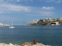
Malta has been a great experience this past week. We have been able to take care of many boat projects and even allowed for some exploring of the island.

Upon arrival we had no idea where we would anchor as this is our first country where we haven’t had any sort of nautical guide book. We found a spot and have been quite pleased with it this past week. Once we got the dingy inflated, we set out to find customs and immigration for a check in. It just so happens that we picked the perfect anchorage because their offices are directly across from us, making it the easiest and cheapest (free!) check in of all time.

Across the street from customs is White Sails Nautical Supplies and they have been great to us all week. We have had outboard engine issues and finally gave up and took it in. Within the day had it back with a new spark plug wire. We also purchased flags for our upcoming stops, a new hose for the water pump, carburetor cleaner, and we got the low­ down of how everything works on the island (i.e. laundry, buses, tours). With all the bashings we have been taking we needed to replace some webbing on the mainsail. So we were directed to Inside Out Boat Furnishings who hooked us up with UV webbing, and they also stitched up our American flag. Everyone here in Malta is super friendly and helpful. It is a welcome relief. It sure makes doing boat errands much more enjoyable.

With a few projects out of the way we jumped into full tourist mode and took a half day’s trip around the island on a double decker bus. There is quite a bit of history to Malta, and it is surprisingly a very metropolitan island. So they have the best of both worlds here. Just a few of the sights we saw on our tour include; the walled city of Valletta, Fort St. Elmo, Fort St. Angelo, Grand Harbor, Blue Grotto, and a Maltese Falcon sanctuary.

Upon inspection of the local grocery stores we were pleasantly surprised at all the great food (black beans and tortillas) and good prices. So we did a huge provision, spending so much money the store gave us two bottles of wine as a thank you. This was the most I have ever spent on groceries in three years.

It was also nice to have laundry done. The last load in a washing machine was done at my mom’s house over a month ago.

Being so close to Italy, the food has a strong Italian influence, and we have had some of the best meals in a long time. We treated ourselves to a nice meal out in the city of Valletta. The home-made ravioli and asparagus risotto were to die for.

Today we pulled into the marina for a water fill up and then to the fuel dock (1.30 euro/liter - a little over USD$7 per gallon) for a topper. We plan to leave tomorrow for Spain, or wherever the wind takes us. As of now it looks like the weather should be ok for the next week. If it cooperates then we will do a posting from sea.

One Love
Amy and Tom

One quick note for all the Popeye fans out there. Popeye the movie was filmed here.